Property Record
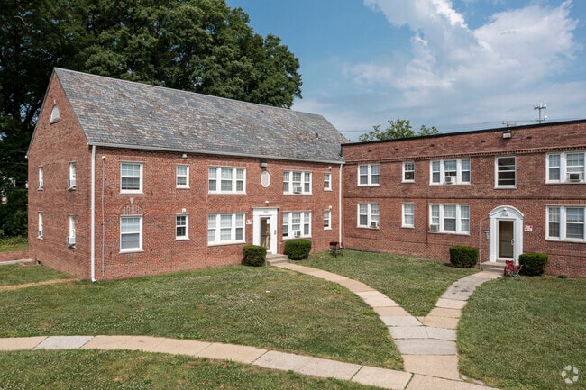
4416 Marble Hall Rd, Baltimore, MD 21218


NEARBY LISTINGS FOR SALE OR LEASE
Property Detail
4416 Marble Hall Rd
Baltimore-Columbia-Towson, MD
Springfield
3971-002
3.200 ACRES
Apartment
Baltimore City
X
Maryland
2400100405G
2
2024
3.20 AC
2025
Original Northwood
270903
Baltimore
DEMOGRAPHICS near 4416 Marble Hall Rd
1 Mile
3 Mile
5 Mile
2024 Total Population
26,872
220,036
565,051
2029 Population
25,463
211,640
549,372
Pop Growth 2024-2029
(5.24%)
(3.82%)
(2.77%)
Average Age
41
39
39
2024 Total Households
10,712
92,584
242,042
HH Growth 2024-2029
(5.60%)
(4.05%)
(3.00%)
Median Household Inc
$58,952
$60,965
$60,514
Avg Household Size
2.30
2.20
2.20
2024 Avg HH Vehicles
1.00
1.00
1.00
Median Home Value
$171,673
$209,237
$230,612
Median Year Built
1949
1949
1951
Nearby Places
Map Layers
Map Styles
 Street
 Aerial
- Restaurants
- Banks
- Shops
- Fitness
- Groceries
PUBLIC TRANSPORTATION
COMMUTER RAIL
Penn Station (PENN - WASHINGTON - Maryland Area Regional Commuter Trains (The MARC), Penn Line - Maryland Area Regional Commuter Trains (The MARC), Penn Station & Camden Yards - Maryland Area Regional Commuter Trains (The MARC))
DRIVE
WALK
Distance
Penn Station (PENN - WASHINGTON - Maryland Area Regional Commuter Trains (The MARC), Penn Line - Maryland Area Regional Commuter Trains (The MARC), Penn Station & Camden Yards - Maryland Area Regional Commuter Trains (The MARC))
9 min
3.3 mi
Camden Station (CAMDEN - WASHINGTON - Maryland Area Regional Commuter Trains (The MARC), Camden Line - Maryland Area Regional Commuter Trains (The MARC))
DRIVE
WALK
Distance
Camden Station (CAMDEN - WASHINGTON - Maryland Area Regional Commuter Trains (The MARC), Camden Line - Maryland Area Regional Commuter Trains (The MARC))
15 min
5.2 mi
AIRPORT
Baltimore/Washington International Thurgood Marshall
DRIVE
WALK
Distance
Baltimore/Washington International Thurgood Marshall
30 min
14.8 mi
Freight Ports
Port of Baltimore
DRIVE
WALK
Distance
Port of Baltimore
21 min
7.1 mi
Nearby Properties
Address
Land Use
TOTAL SIZE
Lot Size
Zoning
Address
Land Use
TOTAL SIZE
Lot Size
Zoning
1,632,000 SF
106.32 AC
EC-2
Address
Land Use
TOTAL SIZE
Lot Size
Zoning
21,312 SF
54.36 AC
EC-2
Address
Land Use
TOTAL SIZE
Lot Size
Zoning
1,228,117 SF
9.43 AC
C-2
Address
Land Use
TOTAL SIZE
Lot Size
Zoning
24,993 SF
66.85 AC
EC-2
Address
Land Use
TOTAL SIZE
Lot Size
Zoning
599,187 SF
30.14 AC
EC-2
Address
Land Use
TOTAL SIZE
Lot Size
Zoning
199,435 SF
1.19 AC
BSC
Address
Land Use
TOTAL SIZE
Lot Size
Zoning
189,700 SF
0.71 AC
TOD-4
Address
Land Use
TOTAL SIZE
Lot Size
Zoning
316,273 SF
25.90 AC
H
Address
Land Use
TOTAL SIZE
Lot Size
Zoning
170,000 SF
0.67 AC
BSC
Address
Land Use
TOTAL SIZE
Lot Size
Zoning
23.09 AC
DR16
Address
Land Use
TOTAL SIZE
Lot Size
Zoning
372,287 SF
0.98 AC
R-10
Address
Land Use
TOTAL SIZE
Lot Size
Zoning
140,000 SF
9.11 AC
EC-2
Address
Land Use
TOTAL SIZE
Lot Size
Zoning
567,521 SF
8.12 AC
R-9
Address
Land Use
TOTAL SIZE
Lot Size
Zoning
5.03 AC
R-10
Address
Land Use
TOTAL SIZE
Lot Size
Zoning
320,000 SF
4.56 AC
TOD-4
Address
Land Use
TOTAL SIZE
Lot Size
Zoning
543,281 SF
7.28 AC
C-2
Address
Land Use
TOTAL SIZE
Lot Size
Zoning
366,234 SF
1.12 AC
R-10
Address
Land Use
TOTAL SIZE
Lot Size
Zoning
303,115 SF
7.62 AC
R-3
Address
Land Use
TOTAL SIZE
Lot Size
Zoning
430,271 SF
56.35 AC
EC-2
Address
Land Use
TOTAL SIZE
Lot Size
Zoning
3.01 AC
EC-2
Address
Land Use
TOTAL SIZE
Lot Size
Zoning
507,813 SF
4.94 AC
TOD-2
Address
Land Use
TOTAL SIZE
Lot Size
Zoning
211,229 SF
7.46 AC
R-9
Address
Land Use
TOTAL SIZE
Lot Size
Zoning
367,920 SF
2.87 AC
R-9
Address
Land Use
TOTAL SIZE
Lot Size
Zoning
0.01 AC
R-3
Address
Land Use
TOTAL SIZE
Lot Size
Zoning
54.25 AC
EC-1
Address
Land Use
TOTAL SIZE
Lot Size
Zoning
287,500 SF
44 SF
R-5
Address
Land Use
TOTAL SIZE
Lot Size
Zoning
507 SF
3.58 AC
R-10
Address
Land Use
TOTAL SIZE
Lot Size
Zoning
245,951 SF
58.90 AC
EC-1
Address
Land Use
TOTAL SIZE
Lot Size
Zoning
1.15 AC
R-10
Address
Land Use
TOTAL SIZE
Lot Size
Zoning
218,005 SF
5.73 AC
R-10
The World's #1 Commercial Real Estate Marketplace
Connect with us
© 2026 CoStar Group
The information above has been obtained from sources believed reliable. While we do not doubt its accuracy we have not verified it and make no guarantee, warranty or representation about it. It is your responsibility to independently confirm its accuracy and completeness. Any projections, opinions, assumptions, or estimates used are for example only and do not represent the current or future performance of the property. The value of this transaction to you depends on tax and other factors which should be evaluated by your tax, financial, and legal advisors. You and your advisors should conduct a careful, independent investigation of the property to determine to your satisfaction the suitability of the property for your needs.